

Field Geology Part 2 - Talkeetna Mountains
Timeline and projects
Part 2 consists of a week of preparation in Fairbanks and the Elliot Highway, followed by the Limestone Gap mapping project.
Preparation: Fairbanks and Elliot Highway (6 days)
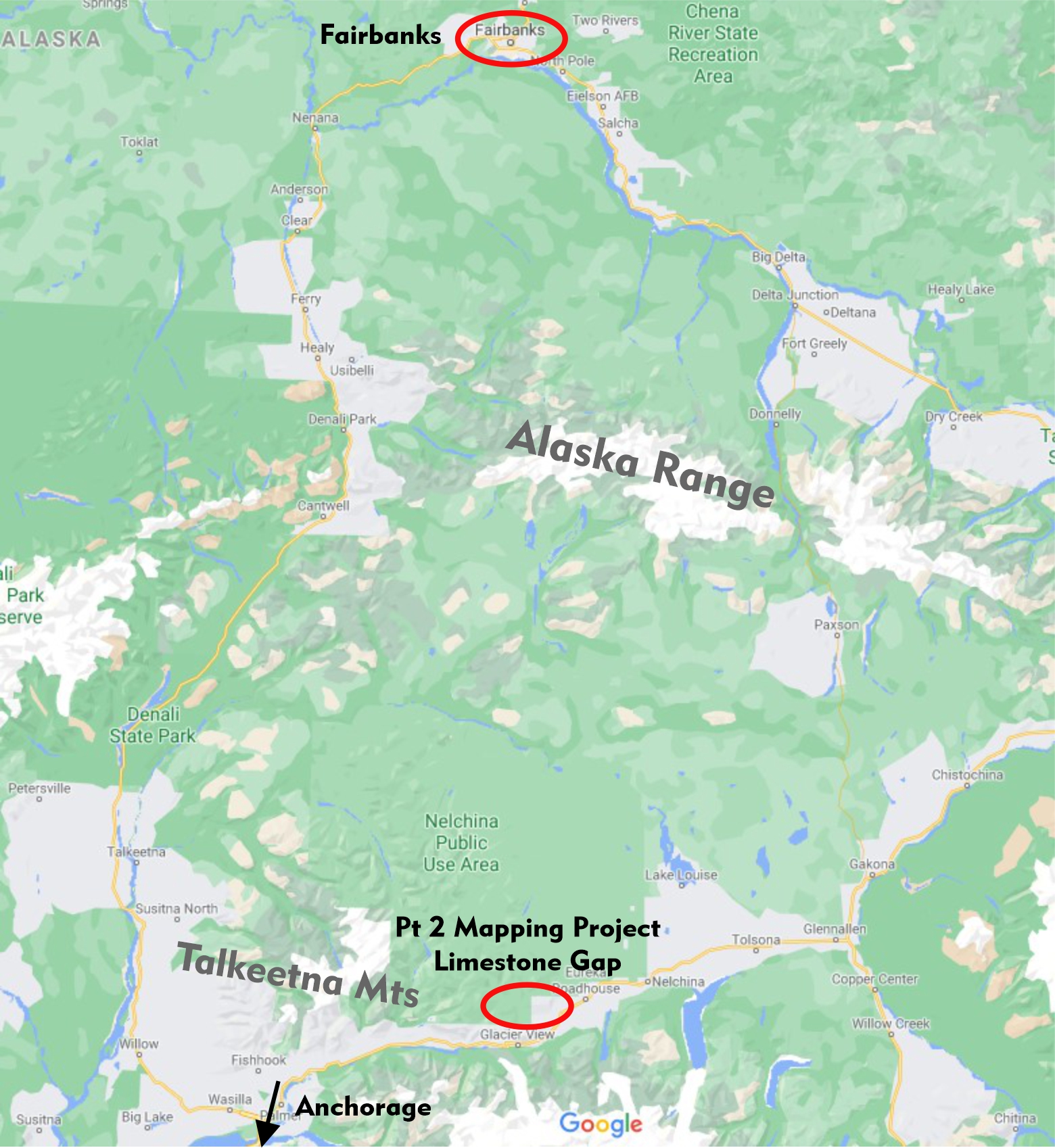
The capstone mapping project of the UAF Geology Field Camp is a fly-in camp located at Limestone Gap in the spectacular eastern Talkeetna Mountains. Getting there not only requires a small plane, but also good preparation. In the week leading up to Limestone Gap, you will strengthen your rock ID, unit description and basic mapping skills during a road trip along the Elliot Highway from Fairbanks to the old mining town of Livengood. If you are worried about structural geology, don’t worry. You will have plenty of opportunities to practice identification and measuring various structure in metamorphic and sedimentary rocks.
In Fairbanks, you will get a refresher in structural analysis (stereonets!) and interpretation of structural data (e.g., fold axes). You will also be introduced to StraboSpot, a great mapping app developed by structural geologists for geologists. Strabo Spot (www.strabospot.org) turns your tablet (or precisely, the iPad we will provide) into a field book, map, compass, GPS and camera. We will use StraboSpot for the Limestone Gap mapping project.
Capstone Project: Limestone Gap, eastern Talkeetna Mountains (20 days)
Aside from mapping the geology and recording a stratigraphic section, outlined in detail below, you will gain first-hand experience in the logistics of a remote field camp that is only accessible via small plane: setting up camp, running a camp and finally demobilization. An experience that you most likely will not have at any other geologic field camp in the US.
Assignments: Stratigraphic section, detailed mapping report, professional geologic map and cross sections.
Syllabus will be available in Fall 2024
Limestone Gap – Talkeetna Mountains
The capstone project is located in the eastern Talkeetna Mountains. Flying out of Sheep Mountain along the Glenn Highway with a small bush plane, the campsite of Limestone Gap is located on a meadow at 5000 feet elevation. For the next two and a half weeks our little camp, a cook tent and two office tents surrounded by a ring of private tents, will call this magnificent tundra landscape home.
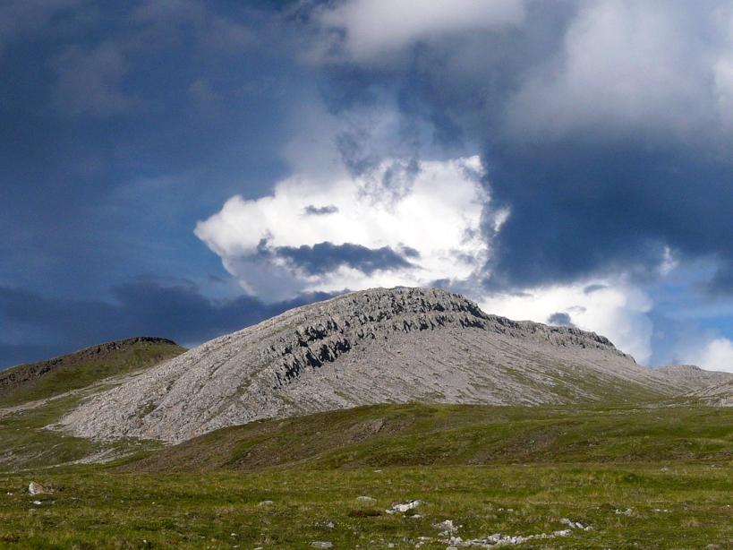
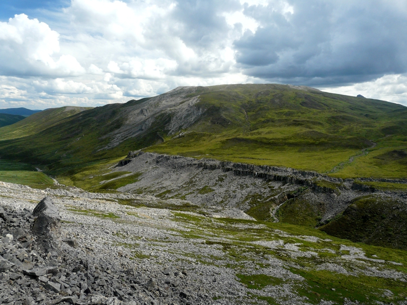
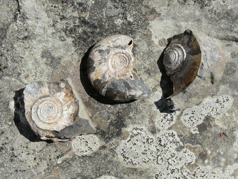
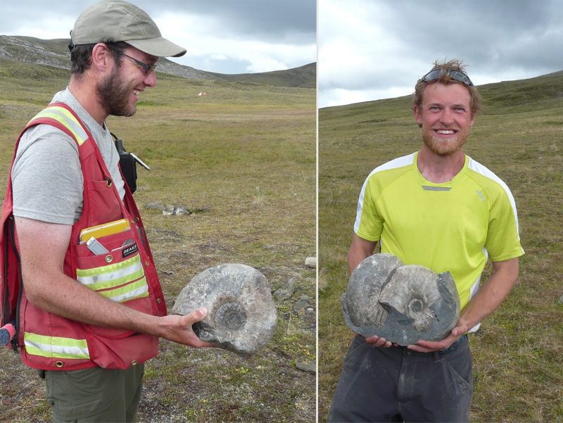
The conditions for mapping are ideal: no need to worry about breaking trail through bush, the geology is well-exposed. The section consists of a Late Jurassic to Cretaceous mostly marine sequence, including black shales of basin origin, storm deposits, and lagoonal or non-marine calcareous clastic rocks. The section is unconformably overlain by a thick section of Tertiary basalts. Basaltic dikes related to the extrusive rocks intrude the clastic section. The sedimentary rocks are highly fossiliferous; ammonites, belemnites, and bivalves are common in parts of the section. The area is located near the eastern limits of the Castle Mountain - Caribou fault system of south-central Alaska, and the layered rocks are faulted and folded in patterns that are a challenge for students to map and explain.
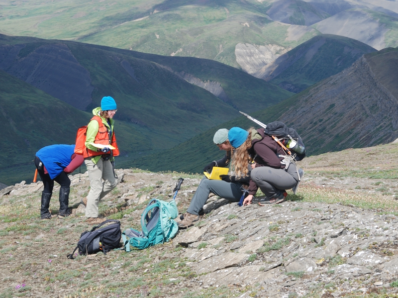
Work in the area begins with measuring and describing several stratigraphic sections, defining map units, and interpreting the depositional history. The remainder of work at Limestone Gap is devoted to completing a geologic map of the 5 km x 6 km study area at a scale of 1:10,000. The structure of the area is diverse and complex, but well-defined marker units, good exposures, and easily negotiated terrain allow students to focus their efforts on locating and tracing contacts on their maps. Students must map contacts of folded and faulted units, faults, and fold axial surfaces, identify different types of faults, and evaluate whether their maps make geologic sense. The conclusion of the project involves compilation of a complete map, preparation of cross sections, interpretation of geologic history based on the mapped cross-cutting relations, and preparation of a report.
Impressions from Limestone Gap
Back to Main Page