

Amchitka Technical Support - Test Site
Project Description
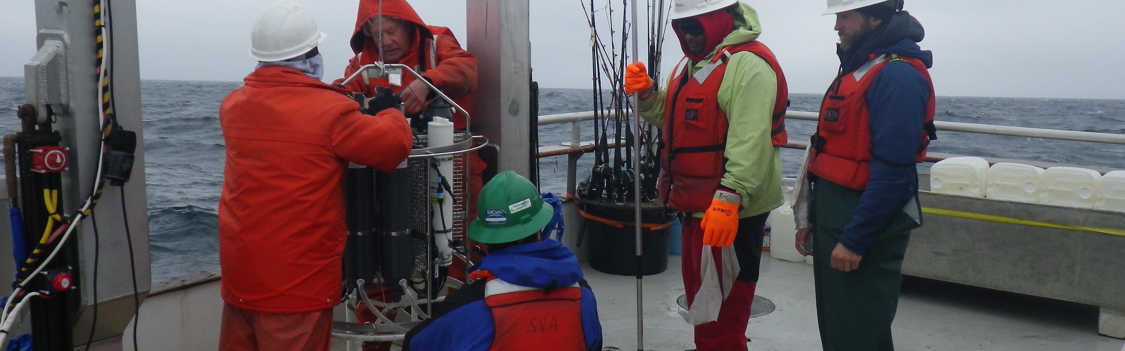
Monitor the nearshore marine community of Amchitka Island of the central Aleutian archipelago relative to underground nuclear testing that occurred in 1965, 1968, and 1971. Conductivity Temperature and Depth (CTD) synopsis, and water sampling for the Amchitka cruise 2016 A Seabird SBE 25 CTD with a six 4 liter Niskin bottle SBE33 sampling carousel was used to sample locations around Amchitka and Adak islands. It contained five sensors measuring, salinity, temperature, pressure, Dissolved Oxygen (DO), and pH. Samples were taken nominally every one second and uploaded via conducting wire to a PC running the Seabird software, Seasave. A typical deployment proceeds as follows, the ship moves upwind of the sampling station and the CTD is deployed as the ship drifts over the station. The location at the beginning and end of the cast is noted in the log and recorded in the file except when GPS data was unavailable. All times are in GMT. At the Long Shot site, due to the presence of high winds and large swell, CTD soak time was minimized at the surface. Thus only upcast data should be used if needed in future data analyses. Per the sampling plan, the CTD is lowered until it is five meters above the bottom. All six bottles are fired and the CTD is recovered. Water is divided between the one liter tritium sample and the 20 liter water sample via a common sampling manifold. Because of the close proximity of the stations and the large amount of drift, many inshore stations were not sampled at Long Shot. Very little, if any water column differentiation was observed at this site. Site Milrow was sampled with a single five liter Niskin lowered to a nominal depth of 10 meters and closed via messenger. Site Cannikin was collected using the carousel at 15 meters of depth corresponding to five meters above bottom. Adak South and North were collected at 5 and 67 meters respectively, thus reflecting the large differences in depths at these sites. CTD data were processed as follows using SBEDataprocessing Win32, first the hexadecimal Seabird format was converted to CNV files. Next a lowpass filter of .15 seconds was applied to the data. A routine was then used to correct for the ships roll. Wild points were then screened out and finally the up and downcasts were separated. Two CTD casts (004 and 008), did not have GPS data available and the station locations were used for the locations in the log. Casts 002 and 003 were included for completeness, however communication with the CTD was lost during both of these casts and the data from them should not be used.
The naming format is as follows: uLS58_019.cnv, where u stands for upcast, LS58 stands for Long Shot number 58 and _019 stands for the 19th cast number. Adak=ADK, Cannikin=CAN
5/20/16
Chase Stoudt: University of Alaska Fairbanks, School of Fisheries and Ocean Sciences
castoudt@alaska.edu
Project Funding
Alaska Department of Environmental Conservation
Amount: $58,062
Start Date: 2014-07-00 End Date: 2015-06-00
Research Team
Douglas Dasher
Principal Investigator
Affiliate Faculty
Specialties:
- Radioecology studies.
- Marine and freshwater aquatic resource surveys.
- Contaminant fate and transport.
- Sediment trace metals and anthropogenic source contribution.
- Development of UAF ESTES-SFOS gamma spectroscopy laboratory for environmental radioactivity studies
Stephen Jewett
Co-Principal Investigator
Professor Emeritus
Specialties:
- benthic ecology
- trophic interactions
- benthic impact assessments
- Arctic ecosystems
- pollution and contamination monitoring
- scuba techniques for scientific divers
- Aleutian Islands nearshore ecosystem
- offshore marine mining impacts
Arny Blanchard
Research Professional
Specialties:
- Environmental Statistics
- Benthic Ecology
- Invertebrate Taxonomy