
ACEP interns contribute to mapping Alaska’s coastline with high-quality data
August 24, 2023
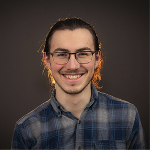
ACEP intern Karsten Sierra worked on the Coastal Mapping project this summer.
This article is part of a series highlighting ACEP’s 2023 cohort of eighteen undergraduate interns. To read about other projects and learn more about the program, please visit the ACEP Internship Program website.
Karsten Sierra and Mary Ella Rinzler worked under Erin Trochim and Noelle Helder this summer on the Coastal Mapping project. Originally from Juneau, Sierra is a junior at the University of Alaska Fairbanks, studying mechanical engineering. Rinzler is a junior at the University of Colorado Boulder, studying physical geography with a passion for raising awareness about the impact of climate change in the Arctic. During a sailing expedition in northern Norway, she observed the inaccuracies present in several navigational charts, stemming from the rapidly changing terrain in the region. This experience led to her interest in pursuing geographic information system (GIS) work.
The Coastal Mapping project is a multidisciplinary research project that aims to map Alaska’s coastline with high-quality detailed data. Despite rapid changes in the coastal zones due to the increasingly warming climate, as of 2023, 66% of the Alaskan coastline is unmapped, and much of the existing mapping requires updating. Accurate geospatial data is vital because Alaska’s diverse marine landscapes are home to Indigenous peoples and coastal communities where they subsist. Topobathy data enables the mitigation of navigability, coastline erosion, flooding and tsunami or mass movement events, and is essential for safe near-coastal navigation. Topobathy data can also be used to determine safe areas for marine infrastructure development, such as the possibility of offshore energy. Working closely with the U.S. Army Corps of Engineers National Coastal Mapping Program and Joint Airborne Lidar and Bathymetric Technical Center of Expertise (NCMP/JALBTCX) and Woolpert, the project supports effective and efficient mapping of the everchanging Alaskan coastline.
Sierra’s main task this summer was learning to clean and process topobathy lidar data. Topobathy lidar is the combination of surface and subsurface lidar scanning, ideal for scanning the coastline. This data is collected by JALBTCX’s airborne Coastal Zone Mapping and Imaging Lidar (CZMIL) sensors and requires editing for quality control. Sierra learned how to read point cloud data and manually edit out sensor noise as well as non-surface features such as birds, ice, and seaweed from the data. Throughout the project he also learned important documentation and writing skills needed to help with the onboarding process of future topobathy data editors.
ACEP intern Mary Ella Rinzler worked on the Coastal Mapping project this summer.
Rinzler’s work on this project was to create a StoryMap — an interactive map for those with limited technical experience — detailing the importance of this project as a whole, as well as how community members can access and use the data to help combat the effects of shoreline change, flooding, and tsunami events. The StoryMap’s purpose is meant to be a learning tool for community members as well as a resource for decision makers. The StoryMap highlights why this data is important, who can benefit from it, how the data is collected, where the data gaps lie, and how those data gaps will be filled. The StoryMap will be published and available online in October.
This summer’s internship challenged Sierra’s ability to interpret technical data and to be able to edit point cloud data.
“I'm also very happy that I learned how to use programs like QGIS and Google Earth Engine. They seemed so mysterious and unapproachable but with the right people I was able to get the basics down!” he said.
Rinzler enjoyed making “a lot of cool maps” and working with “pretty cool people” during her internship. Most importantly, she learned why it is crucial to make your work accessible to others, especially the people most affected.
“Not only is it important to share data, but it’s important to create a space that allows people to understand how that data can be useful to them and any problems they are facing,” she said.
This internship is funded by the National Science Foundation and Woolpert, Inc. under a professional services agreement with the U.S. Army Corps of Engineers for the JALBTCX project. View the final presentation for this project on ACEP’s YouTube Channel. For more information on this project, please contact Erin Trochim at edtrochim@alaska.edu.