

New method of monitoring shore ice could improve public safety
Rod Boyce
907-474-7185
March 28, 2023
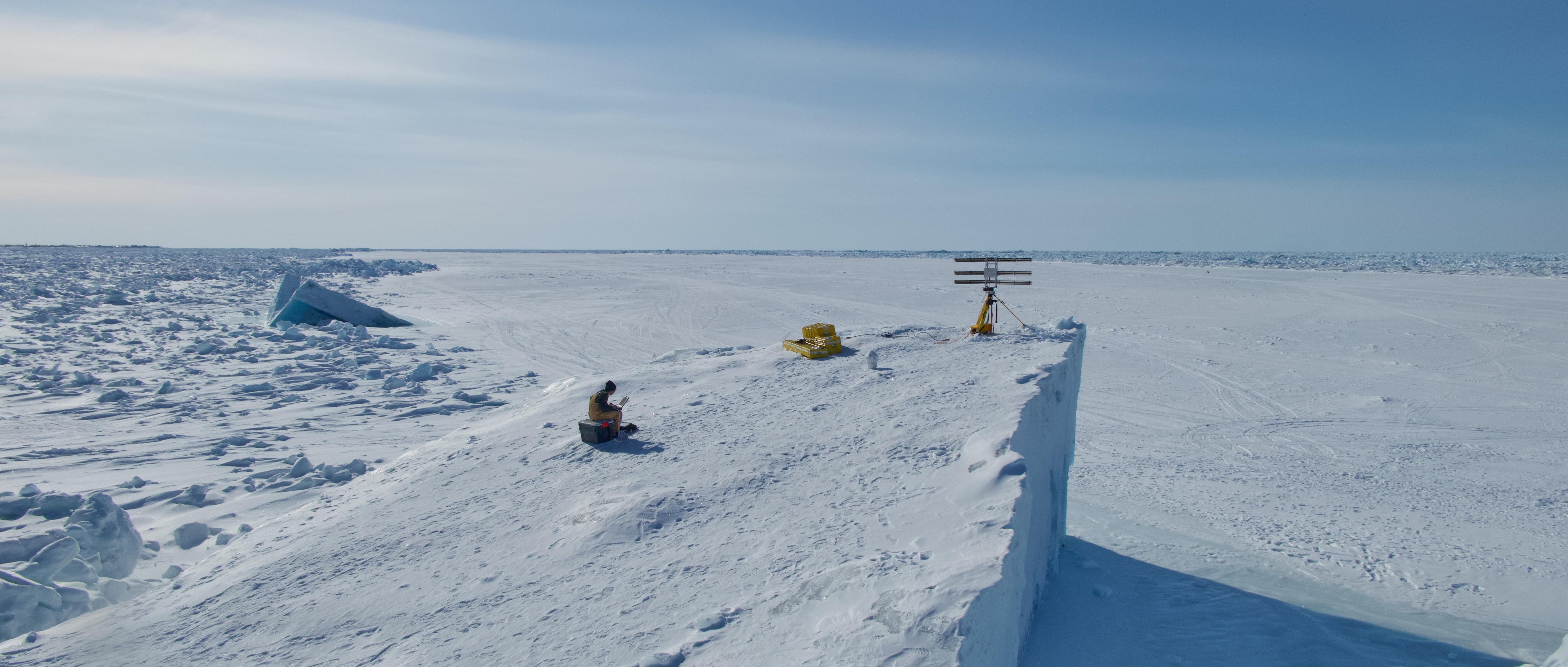
Graduate student researcher Emily Fedders sits on top of an ice island with the portable interferometric radar. The ice island is in landfast sea ice on Alaska’s Arctic coast near Utqiaġvik.
Specialized portable radar could serve as an early warning system to reduce risk for humans working on shorefast sea ice, according to a recently published study.
The researchers suggest that use of portable interferometric radar can quickly reveal small changes that could indicate imminent movement or detachment of the ice, which is important as climate change affects ice behavior. The capability could also be useful for near-coastal navigation.
“If you want to learn about what makes the shorefast ice go unstable and detach from the coast, we need to be able to detect some early warning signals,” said research assistant professor Andy Mahoney of the University of Alaska Fairbanks Geophysical Institute.
Shorefast ice—also known as landfast ice—is ice that’s attached to the shore.
“Satellites give you snapshots that are separated by hours if not days,” he said. “This portable ground-based system can be looking continuously for signs of instability.”
The research was published in January in the journal Cold Regions Science and Technology. Former UAF graduate student Dyre Oliver Dammann is the lead author. UAF oceanography professor Mark Johnson, Mahoney and Geophysical Institute colleagues Emily Fedders, a graduate student researcher, and research professor Mark Fahnestock are among the seven co-authors.
Imagery from a portable ground-based radar interferometer can reveal sea ice changes down to the centimeter and millimeter levels. The devices can monitor areas continuously.
Interferometric radar differs from regular radar in that it compares two different images of an object to identify small changes in the distance to it. By collecting a near-continuous time series of data from a single location, the coast-based interferometric radar can measure the compression or stretching of sea ice before it fails. It also can detect small cracks that might go unnoticed by observers on the ice.
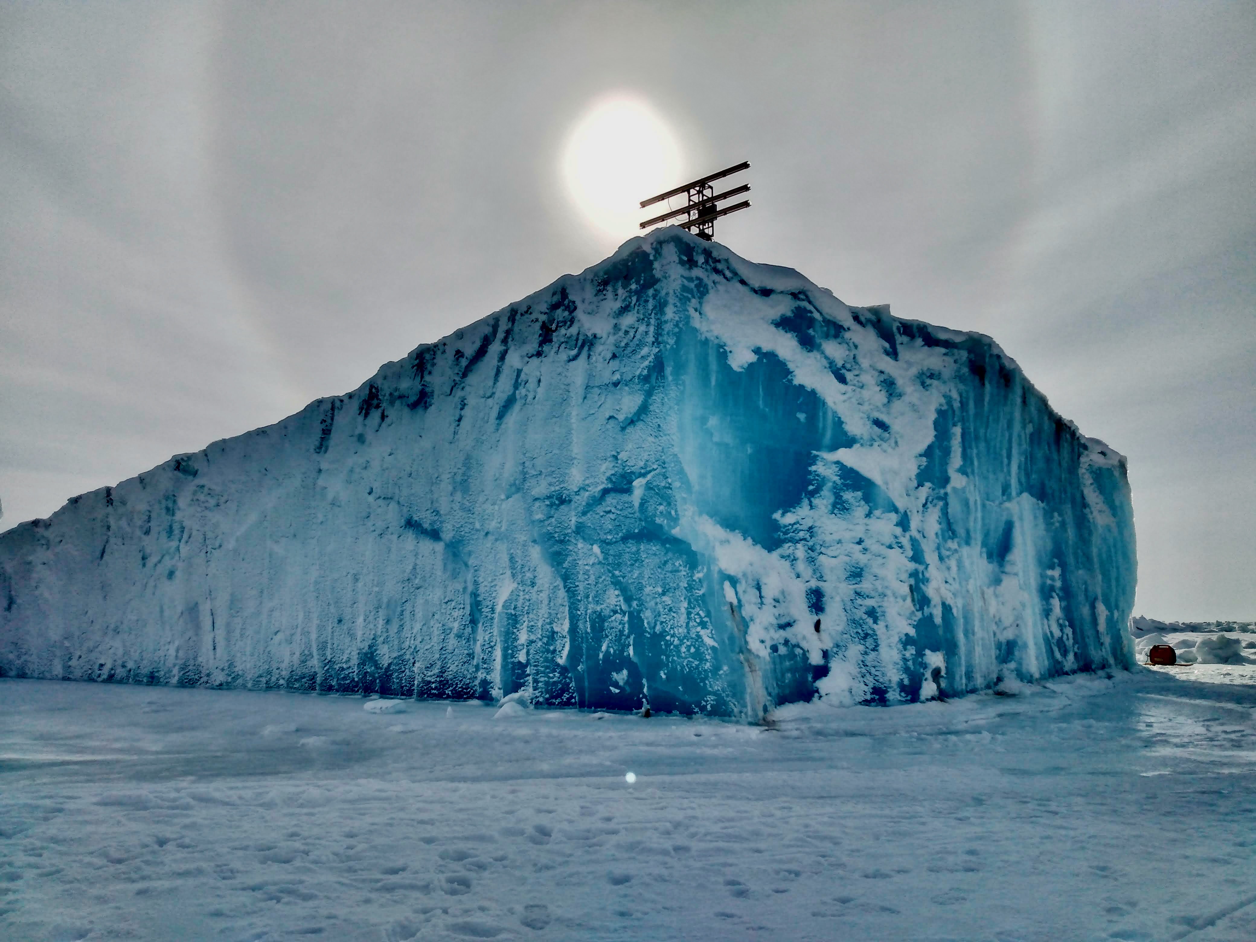
A portable interferometric radar unit sits atop an ice island near Utqiaġvik, Alaska.
Researchers from the UAF Geophysical Institute, the UAF College of Fisheries and Ocean Sciences and institutions in Oregon, New Hampshire, Norway and Japan collected and analyzed several series of measurements in Utqiaġvik, Alaska.
They used the portable interferometric radar to look for evidence of strain on the ice from wind and sea level change. The radar could detect displacement of as little as 1 centimeter.
Landfast ice in shallow water depths such as that near Utqiaġvik consists of pans of smooth, floating ice anchored by ridges of deformed ice resting on the seafloor. Winds and currents alone typically do not dislodge ice grounded in this way. Storm surges or high tides, coupled with onshore winds, can lift the grounded ice and make it more likely to detach.
The researchers concluded that processing radar data in near real time can reduce risk to humans on the ice by serving as an early warning system for fracturing, destabilization and break-out events. It could also serve as a warning to vessels navigating near the coast.
They also state that seasonal monitoring could aid in long-term strategic decision-making in response to large-scale environmental change.
The research is the latest in a continuing effort to better understand the behavior of coastal ice.
The aim is to gather interferometric images of a variety of ice interactions: landfast ice interacting with the drifting ice, landfast ice affected by wind and landfast ice during a period of higher sea level due to onshore wind, for example.
“Through these observations, we can learn a little bit more about how landfast ice responds in these different scenarios,” Fedders said. “The eventual goal would be to incorporate that into a better prediction of land-fast ice stability.”
Researchers were back in the area last year.
“We saw some interesting tidal motions during a period when there wasn’t pack ice up against the landfast ice, where a lead was open,” Fedders said. “That was something we hadn't captured with the radar before.”
ADDITIONAL CONTACTS: Andy Mahoney, armahoney@alaska.edu; Emily Fedders, erfedders@alaska.edu.
156-23