

Monitoring climate change from space, one leaf at a time
September 14, 2018
Heather McFarland
907-474-6286
Download text and photo captions here.
A new Japanese satellite will monitor global climate change and the health of the Earth, from space. Scientists are now validating the satellite by gathering and measuring thousands of leaves from around the world, a feat possible only through international collaboration.
As plants grow, they use the sun’s energy to convert carbon dioxide to oxygen and energy, a process called photosynthesis. Current estimates suggest that plants absorb as much as a quarter of the excess carbon dioxide emitted by humans. Nicknamed Shikisai, meaning colors in Japanese, the satellite GCOM-C will help researchers understand the important role that plants play in mitigating the impacts of climate change.
Measuring from space the amount of carbon dioxide that black spruce and other forest types can absorb is problematic. You cannot see carbon in the colored pixels of a satellite image.
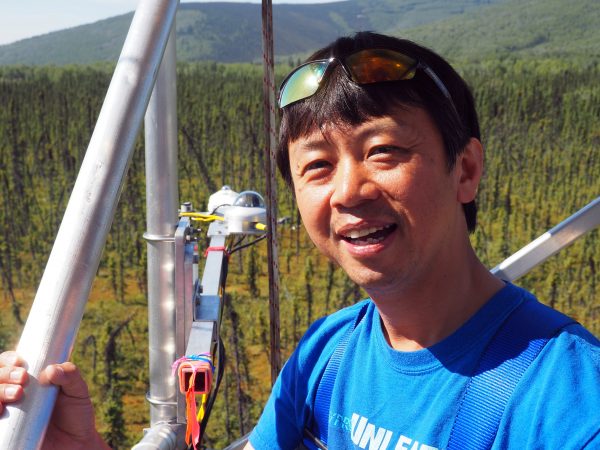
That’s where Hideki Kobayashi from the Japan Agency for Marine-Earth Science and Technology comes in. Kobayashi, a JAMSTEC environmental scientist, uses on-the-ground measurements to estimate carbon absorption and validate satellite observations.
“I am trying to create a global map of leaf area index,” said Kobayashi.
A "leaf area index" is the measurement of the total leaf area of trees and understory plants compared to the area of the sampling plot. The index indicates how much photosynthesis occurs in a forested area and thus helps in calculating how much carbon dioxide the area absorbs.
Kobayashi's plan is relatively simple. For every forest type, he estimates the average leaf area index of plants in a pixel-sized area, measures the carbon absorbed by those plants and estimates the amount of carbon dioxide that vegetation in any given pixel can absorb. This “simple” process means taking thousands of leaf samples from forests around the world, including the boreal forest — the world’s largest biome.
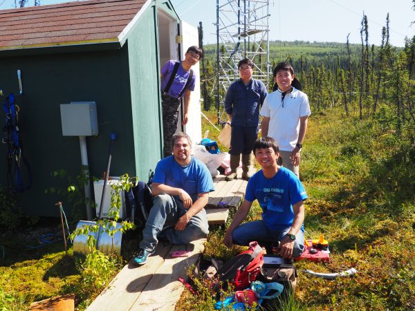
Gathering leaves from the boreal forest is what draws Kobayashi to Poker Flat Research Range, located in a black spruce forest 30 miles northeast of Fairbanks. The site has been the focus of collaboration between UAF’s International Arctic Research Center and JAMSTEC for more than a decade.
The location is special because it is secure, has a long history of environmental data collected by IARC and JAMSTEC, and, most importantly, it is flat. Since a single satellite pixel represents 250 square meters on the ground Kobayashi needs a level sampling location of the same size.
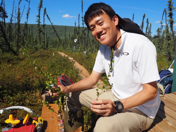
Even with help, he can’t measure every leaf in an area that large. Instead, he identifies several smaller plots within the larger area and removes all the plants except moss and lichen. It takes at least an hour to finish a 50-by-50 centimeter plot.
At a lab in IARC, the team dries all the plants and separates them according to species. After removing the woody stems, they measure and weigh the remaining green parts, where the photosynthesis happens, and determine the average leaf size of all the understory plants and the spruce trees. With this number, Kobayashi can determine the average leaf area index for plants in the boreal forest.
Over the past few years Kobayashi, working with IARC scientists and engineers, has used instruments to measure carbon rising from the ground and falling from the sky. These measurements allow Kobayashi to estimate the carbon absorbed by the boreal forest from space. Collaborators from around the world are gathering similar data to calibrate the Shikisai satellite for a diverse range of habitats.
“It is difficult to maintain this kind of study by myself,” said Kobayashi. “So many people have helped me.”
In Alaska, in additional to the scientific collaboration, he leans on IARC to maintain research infrastructure, supply student volunteers and provide a lab for examining leaf samples.
IARC Director Hajo Eicken traveled to Japan in August to discuss future JAMSTEC-IARC collaborations. Next, the team plans to demonstrate the value of combined satellite and on-the-ground measurements to help predict landscape change.
UAF’s Poker Flat site is unique because collaborators can gather measurements that extend from the atmosphere, through the plant cover, into the permafrost.
“It is a key location to study the response of plants and permafrost soils to changes that are in part driven by what is happening over the warming oceans around Alaska,” Eicken said.