

Intern uses drone images to map coastal permafrost and erosion
June 8, 2020

A research project is using aerial images to study the characteristics of permafrost and coastal erosion processes relevant to energy and power applications on Alaska’s North Slope coast.
Logan Borger, a sophomore studying mechanical engineering at UAF, is part of a project team using photogrammetric imagery processing techniques to study aerial photographs collected as part of Task 6 of the "Secure and Resilient Power Generation in Cold Regions Project." This project is funded by the U.S. Army Corps of Engineers' Engineer Research and Development Center.
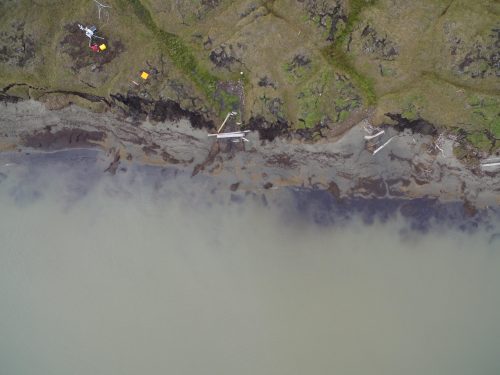
Borger, working with researcher Erin Trochim, will be taking images captured from an unmanned aerial vehicle, or drone, and creating digital surface models for this area. Borger is a summer intern with UAF's Alaska Center for Energy and Power, and recently worked on a new site, in Foggy Island Bay.
For more information, email Amanda Byrd at agbyrd@alaska.edu.