

Alaska writer buckling under pressure
Ned Rozell
907-474-7468
March 12, 2026
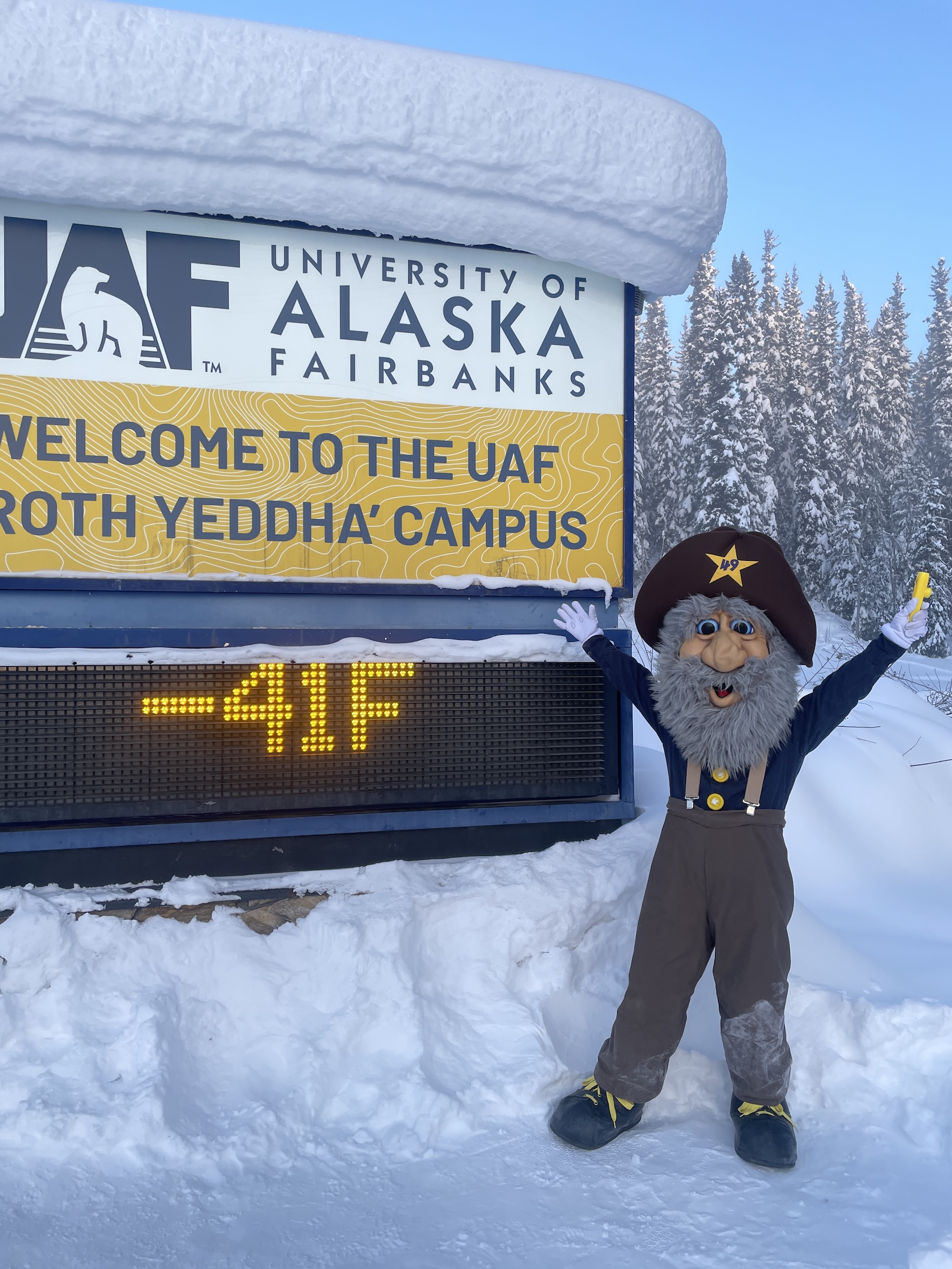
Alaska Goldpanners baseball team mascot Happy Boy (aka Chris Carlson of Fairbanks) poses in front of the University of Alaska Fairbanks temperature sign on the morning of March 1, 2026.
Thirty below again this morning. OK then. Time to reach for the baseball bat and fine-tune the weather station.
Just kidding. But it’s been quite a winter in the Golden Heart of Alaska. We’ve been at it long enough now that numbers are tumbling in from the meteorologists at the National Weather Service office in Fairbanks.
My favorite statistic requires we middle Alaskans to remember what we were doing on Halloween 2025 — also known as the last day Fairbanks air was at or above 33 degrees Fahrenheit.
While Spidermans and witches stood at doorways dripping with cold rain, we old-timers bragged of trick-or-treating at 20 below.
Oops. The weather gods then dialed up a December to Remember, with more than one month — extending into January — when our thermometers did not rise above zero.
When the new year’s 2 degrees above zero felt like we were on the beach in Tampa, we were over the hump, right? Nope.
With the sub-40-below temperatures recorded at our airport on March 10 and 11, 2026, we have passed the winter of 1905-1906: 29 different days that featured minus 40 temps or colder. Only five winters since the early 1900s have had a longer stretch of cherry-red woodstoves.
And snow — c’mon! We love you but don’t want to see you falling from the sky again. Especially after February 2026, when a parade of storms dumped more than 2 feet on our not-up-to-code shed roofs.
I now hear the voices of my brothers in New York: “Stop your whinin’. You chose to live there, dog.”
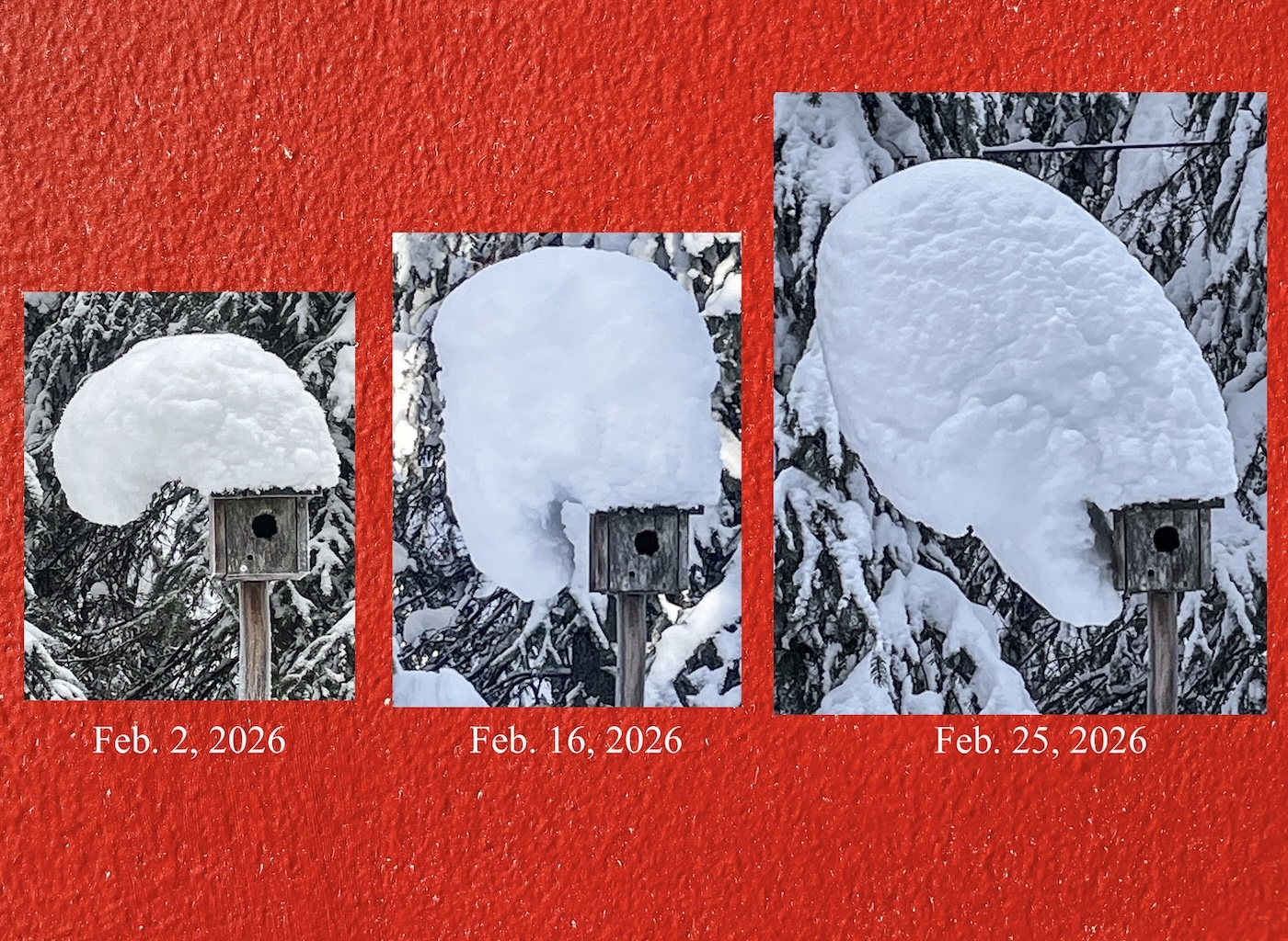
In February 2026, a snow hat forms and deforms on top of a chickadee house in Fairbanks built by the late biologist David Klein. A moose bumped it and knocked off the mass on March 9, 2026.
True dat. Because the spruce valleys and white blanket covering the north half of Alaska are still excellent at making cold, sometimes our water stops coming out when I turn on the tap. Then the ol’ E-2 code starts blinking on our heater — out of diesel again!
But wait — wasn’t last winter so warm that my friend Chris Swingley wondered if his creek-bottom homestead would hit 40 below by the end of the year? It did, of course, in early December 2025, and registered minus 49.9 degrees F just last week!
And isn’t Alaska on an extreme warming trajectory, at more than twice the rate of the rest of the heating-up world?
Yes, it is. Despite our cold weather, 2025 was warmer than the long-term average, by far.
Then how has our frozen-at-half-mast-windshield-wiper winter of 2025-2026 happened?
“The atmosphere got stuck in a pattern,” said Alaska State Climatologist Martin Stuefer, also a professor at the University of Alaska Fairbanks
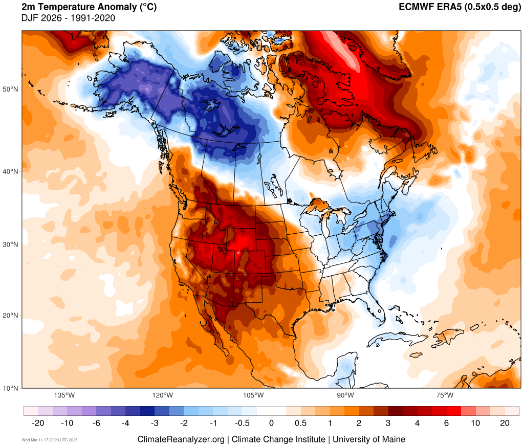
This map of North America shows the winter of 2025-2026 (December-February) temperature anomalies compared to winters from 1991-2020. The distribution of the anomalies was affected by a stalled jet stream flow of air.
Geophysical Institute. “A big high-pressure system sat repeatedly over the Bering Sea/northern Pacific basin, and a lower pressure over northern Canada circulated Arctic air into Alaska and Canada.
“That acted like a roadblock in the jet stream.”
That atmospheric traffic jam has backed up stale, frigid air into Tanana, Tok, Whitehorse, Saskatoon and Sudbury.
“At the moment, cold air is locked up in northern North America, where, unusually, from the Bering Sea to the Atlantic, most areas between 55 and 75 degrees north are colder than normal,” said northern climate expert Rick Thoman of UAF’s Alaska Center for Climate Assessment and Preparedness.
Will we ever achieve Fair-a-dise, when 12 hours of spring sunshine pleasantly punishes you for forgetting your sunglasses (but you dang sure know where your headlamp is) and the air doesn’t nibble your skin like a vole?
The experts claim that outcome is likely. But they can’t say when. Nervous giggle.
Since the late 1970s, the University of Alaska Fairbanks' Geophysical Institute has provided this column free in cooperation with the UAF research community. Ned Rozell is a science writer for the Geophysical Institute.