AK_ARISE
Update highlights
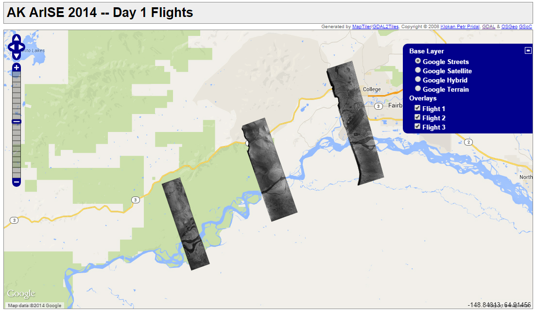
- Check out our AK-ArISE video clips and radar image map view interface.
- Don't forget our blog.
Project Background and Goals
There has always been significant interest at UAF and in the State of Alaska in testing
the benefit of low-cost, UAS-ready airborne SAR systems for a range of Alaska’s geoscience
and hazard applications. Through a NASA EPSCoR grant entitled “Quantifying Fuel Impacts
on Wildfire Behavior and Emissions by Coupling Small Unmanned Aircraft In-situ Measurements
with Satellites Observations,” we now have the opportunity to bring one of the market-leading
UAV-ready airborne SAR systems up to Fairbanks for a two month period. The flexibility
of the system will allow us to test its applicability to a wide range of Alaskan communities
and the Alaskan industry as a means to quickly survey and respond to natural and anthropogenic
disasters.
Sensor Information
Sensor:
- L-band version of the SlimSAR system, produced and marketed by the company ARTEMIS
- Multi-frequency, multi-polarization
- High resolution
- Small-scale and light weight
- Easy to deploy
- Supports various InSAR/polarimetric modes
Our Team
Management team:
|
| Franz Meyer |
UAF/ GI |
Project PI, Lead of Radar and Flight planning team |
| Scott Arko |
UAF/ ASF |
Lead of data processing and product generation |
| Dayne Broderson |
UAF/GINA |
Data distribution |
| Jeremy Nicoll |
UAF/ ASF |
Quality control |
| Eyal Saiet |
UAF/ ACUASI |
Mission coordination |
| Michael Hatfield |
UAF/ ACUASI |
Planning support |
Support team members:
|
| David McAlpin |
UAF/GI |
Mission supplement support |
| Charley Slater |
UAF/ASF |
Quality control support |
| Wenyu Gong |
UAF/GI |
Website development |
Sponsors